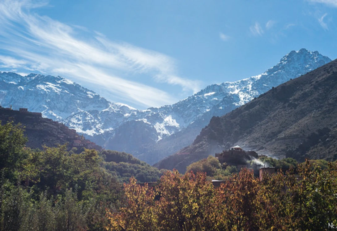
Atlas Hiking Routes: A Seasonal Trail Intelligence Guide
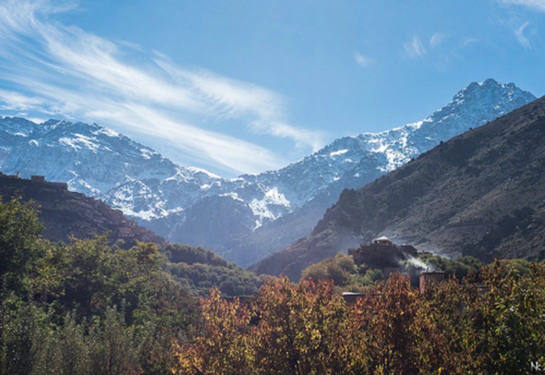
Master the elevation-driven timing of Berber village corridors and high-pass routes to keep groups moving
Learn how Atlas Mountain hiking routes shift by season, elevation, and cultural rhythm. This guide gives tour operators a decision framework for trail timing based on terrain intelligence rather than generic calendars.
TL;DR
Think in elevation bands, not seasons alone — Village corridors (below 2,000m) behave completely differently from high passes (above 3,000m), and each elevation band has its own seasonal window of optimal access.
Spring and autumn are the most versatile windows — Spring (March through May) offers progressive elevation access as snow melts; autumn (September through November) combines stable weather with harvest-season cultural depth across the full range.
Summer is for high altitude, winter is for villages — High passes open reliably from June to October, but low elevations bake in summer heat. Winter closes everything above 2,500m but opens quiet, intimate village trails below.
Build flexibility into every itinerary — Shoulder periods and winter require route alternatives. The guide's real-time terrain assessment, not the calendar, should determine each day's plan.
Local guide intelligence is your most valuable asset — No seasonal calendar replaces someone who walked or rode the trail yesterday. Partner with operators whose guides live in the terrain year-round.
Guide Orientation: What This Covers and Who It's For
This guide maps the seasonal rhythm of hiking routes and riding trails across Morocco's Atlas Mountains, from the walnut-shaded village paths of the Ourika Valley to the exposed switchbacks above 3,000 meters. It's written for adventure travel coordinators, boutique tour operators, and travel agents who need to answer a specific question: when can my group actually move through this landscape, and when should we plan around it?
By the end, you'll understand which elevation bands open and close in each season, why Berber village corridors behave differently from high-pass routes, and how to build trip timing around terrain intelligence rather than generic calendars. This is not a gear list or a fitness guide. It's a decision framework for seasonal route selection.
Why Seasonal Trail Intelligence Matters
The Atlas Mountains are not a single environment. They're a stack of climate zones compressed into a few thousand vertical meters. A trail that's dry and fast at 1,800 meters in April might be a loose, sun-blasted furnace in July. A pass that connects two valleys in September might be buried under snowpack by December. Treating the Atlas as one destination with one "best time to visit" is the fastest way to strand a group on a detour.
For operators sourcing authentic experiences, the cost of getting this wrong is real. A group rerouted around a closed pass loses a day. A group sent into summer heat at low elevation loses enthusiasm. A group booked into a village during a season when the surrounding trails are washed out or snowbound misses the point of being there entirely. The main trekking season runs from March to November , but that eleven-month window contains radically different conditions depending on where you are in the range.
The operators who build repeat business and earn referrals are the ones who match their groups to the right trails at the right time, not just the right destination. That requires understanding the Atlas as a living system of interconnected routes that shift with snowmelt, harvest cycles, and valley wind patterns.
Core Concepts: How Atlas Trails Actually Work
Elevation Bands, Not Trail Ratings
Forget universal trail difficulty ratings for a moment. In the Atlas, the most useful way to think about route selection is by elevation band. Below roughly 2,000 meters, you're in the village corridor: irrigated terraces, mule paths between settlements, and relatively stable year-round access. Between 2,000 and 3,000 meters, you enter transitional terrain where snowmelt timing, scree exposure, and afternoon weather shifts define the riding and walking window. Above 3,000 meters, you're in high-pass territory where winter conditions require crampons and ice axes , and summer offers only a narrow window of reliable access.
Village Corridors vs. High Passes
This is the distinction that separates useful planning from guesswork. Berber village trails are heritage trails in the truest sense: paths worn into the landscape by centuries of trade, agriculture, and daily life. They connect communities, follow water sources, and stay at elevations where human settlement is viable. High passes, by contrast, are transit routes. They exist to cross barriers, not to linger in. The seasonal behavior of these two trail types is fundamentally different.
The Misconception of a Single "Best Season"
Many generic hiking calendars recommend spring and autumn and leave it at that. While spring (March through May) and autumn (September through November) are indeed the most versatile windows, this framing obscures the fact that every season opens specific opportunities. Winter unlocks quiet village trails. Summer opens high passes. The question isn't "when is best" but "best for what route, at what elevation, for what kind of group."
The Seasonal Framework: Four Windows, Three Elevation Bands
The method here is straightforward. We divide the year into four seasonal windows and overlay them against three elevation bands. Each combination produces a different set of trail conditions, cultural opportunities, and logistical constraints. The four windows are: Spring (March through May), Summer (June through August), Autumn (September through November), and Winter (December through February). The three bands are: Low Village Corridors (below 2,000m), Mid-Altitude Transitional Terrain (2,000 to 3,000m), and High Passes (above 3,000m).
Each step below walks through one seasonal window, mapping what opens, what closes, and what decisions you need to make for group routing. A fifth step addresses the transitional shoulder periods that don't fit neatly into calendar months.
Step-by-Step Seasonal Breakdown for Atlas Hiking Routes
Step 1: Spring (March Through May) — The Full-Range Window
Objective: Understand why spring offers the widest route selection and how to sequence elevation gains as the season progresses.
Spring is the Atlas at its most generous. Valley temperatures sit between 14 and 22°C , lower village paths are clear, and wildflowers carpet the terraced hillsides. Snowmelt feeds the rivers, which means irrigation channels are full and the villages are alive with agricultural activity. This is the season when trail user engagement is highest: your group encounters farmers, shepherds, and families moving along the same paths they're walking or riding.
In March, stick to routes below 2,500 meters. Snow still holds above that line, and meltwater can make mid-altitude trails muddy and unpredictable. By late April, the transitional band opens up. By May, experienced groups can begin approaching the lower high passes, though conditions above 3,500 meters remain variable. The key decision is sequencing: start low, move higher as the weeks progress.
Anti-patterns: Don't book a high-pass traverse in early March expecting clear trails. Don't assume that "spring" means uniform conditions across the range. A March trip and a May trip are functionally different adventures.
Success indicators: Your group moves through village corridors without detours, encounters local life along the trail, and gains elevation progressively without hitting snowpack. If you're planning a first cycling trip through Morocco , spring's forgiving temperatures and clear lower trails make it the most accessible entry point.
Step 2: Summer (June Through August) — The High-Pass Opportunity
Objective: Recognize summer as the high-altitude window and manage the heat constraints at lower elevations.
High-altitude Atlas trails open from June to October , making summer the only reliable window for routes above 3,000 meters. The snow has melted from all but the highest north-facing couloirs, and passes like Tizi n'Tichka and Tizi n'Test are fully accessible. For groups seeking the dramatic, exposed ridgelines and the sense of crossing between worlds, this is the season.
The tradeoff is heat. Below 2,000 meters, temperatures in July and August can push past 35°C, making low-elevation village trails uncomfortable and, for some groups, unsafe. The smart play is to spend summer above the heat line. Route plans should start and end at altitude, using vehicle transfers to skip the baking valley floors rather than riding or walking through them.
Anti-patterns: Don't route a group through low-elevation Berber villages in July expecting the same experience as spring. The villages are still welcoming, but the trails are dusty, the heat is oppressive, and the agricultural rhythm has shifted to early-morning and late-evening activity. Don't ignore hydration logistics at altitude, where dry air and UV exposure compound quickly.
Success indicators: Your group accesses passes that are closed the rest of the year, rides or walks above the heat line, and returns with the kind of high-exposure landscape experience that defines a trip. Understanding experiential terrain knowledge and safety beyond trail ratings becomes critical at these elevations.
Step 3: Autumn (September Through November) — The Harvest Window
Objective: Leverage the convergence of stable weather, cultural activity, and full-range trail access that makes autumn the most complete season.
If spring is the Atlas at its most generous, autumn is the Atlas at its most rewarding. Stable days between 15 and 25°C coincide with walnut, almond, and saffron harvests in the villages. The light turns golden. The trails are dry and firm after summer. And critically, both high passes and village corridors are accessible simultaneously, giving you the widest route-planning flexibility of any season.
September still carries summer's warmth at low elevations, so early autumn trips benefit from the same high-altitude bias as summer. By October, the full range is comfortable. November introduces the first weather variability: early snowfall can dust passes above 3,500 meters, and afternoon clouds build more frequently. The window narrows as the month progresses.
Culturally, autumn is when village life is most visible on the trails. Harvest activity means mule trains moving produce, families working terraces, and communal processing of crops. For operators selling authentic, immersive experiences, this is the season that delivers the stories your clients will retell. The best time to visit Berber villages is consistently identified as April through June and September through November , and autumn's harvest energy gives it a slight edge for cultural depth.
Anti-patterns: Don't treat November like October. Weather shifts quickly in late autumn, and a pass that was clear on Monday can be dusted with snow by Thursday. Don't skip the village stops in favor of pure trail time; the harvest interactions are what differentiate an Atlas autumn trip from any other mountain experience.
Success indicators: Your group experiences both high-pass terrain and village-level cultural immersion in a single trip. Clients return with photographs of landscapes and people, not just mountains. These peak periods are when booking ahead is specifically recommended , so early planning is essential.
Step 4: Winter (December Through February) — The Village Season
Objective: Understand winter as a viable, intimate season for lower-elevation routes and manage expectations around high-altitude closures.
Winter is the season most operators write off, and that's exactly why it rewards those who understand it. Heavy snowfall closes high mountain roads and passes between December and March , and anything above roughly 2,500 meters becomes the domain of mountaineers, not trekkers or riders. But below that line, the Atlas is quiet, clear, and surprisingly accessible.
Village corridors at 1,200 to 2,000 meters remain walkable and rideable through most of the winter. Daytime temperatures in the valleys hover around 8 to 15°C, which is cool but comfortable for active movement. The villages themselves are in their quietest phase, with fewer tourists and a slower rhythm. For groups seeking solitude and genuine cultural exchange rather than spectacle, winter delivers an experience that no other season can match.
The key constraint is flexibility. Winter weather in the Atlas is more variable than any other season. A sunny Tuesday can give way to a rainy Wednesday that muddies trails and swells river crossings. Route plans need built-in alternatives, and your local guide's real-time terrain knowledge becomes the most important asset in your logistics chain. This is where operators like Atlas Mountain Bike , whose guides live in and ride these valleys year-round, provide intelligence that no seasonal calendar can replicate.
Anti-patterns: Don't promise high-pass access in winter. Don't assume that "lower elevation" means "easy." Winter village trails can be technical, with wet rock, narrow paths, and occasional ice at shaded sections above 1,800 meters. Don't skip the flexibility margin in your itinerary.
Success indicators: Your group moves through quiet villages without competing with crowds, experiences the intimate side of Atlas culture, and returns without a single weather-forced cancellation because the itinerary had room to adapt.
Step 5: Shoulder Transitions — Reading the Shifts
Objective: Develop the judgment to plan around the unpredictable weeks between seasons, where the best and worst conditions coexist.
The calendar boundaries between seasons are human inventions. The Atlas doesn't flip from winter to spring on March 1st. The real transitions happen across two to four weeks of variable conditions, and these shoulder periods are where planning skill matters most.
Late February to mid-March is the winter-to-spring transition. Snowmelt begins at lower elevations, trails below 2,000 meters start drying out, but rain is frequent and unpredictable. Late May to mid-June is the spring-to-summer shift, when heat builds at lower elevations and the last snow clears from high passes. Late November to mid-December reverses the autumn pattern, with the first significant snowfall arriving at mid-altitude.
For these periods, the decision framework is simple: plan for the worse season and be pleasantly surprised by the better one. Build itineraries with low-elevation anchors and optional high-elevation extensions. Communicate to clients that these shoulder windows offer the possibility of extraordinary conditions (a clear high pass in early March, a warm November ridgeline) but require the flexibility to pivot if conditions don't cooperate.
Anti-patterns: Don't sell shoulder-period trips as guaranteed experiences. Don't build rigid itineraries that depend on specific passes being open. Don't ignore local weather intelligence in favor of historical averages.
Success indicators: Your group has a memorable trip regardless of which conditions materialize, because the itinerary was designed to flex. The guide's real-time assessment, not the calendar, determines each day's route.
Practical Examples: Mapping the Framework to Real Decisions
Scenario 1: A Travel Agent Booking a Group of Six for "Sometime in Spring"
The client says spring. You need to ask: what kind of spring? An early March trip means village corridors in the Ourika or Azzaden valleys, with terraced paths, river crossings, and almond blossoms. The group stays below 2,500 meters, sleeps in village guesthouses, and experiences the Atlas as a living agricultural landscape. A late May trip means you can push to the Tizi n'Tichka area, ride or walk transitional terrain, and potentially access lower high passes. Same season, completely different trip.
The decision point: ask about your clients' fitness, their appetite for exposure versus cultural immersion, and whether they want flowers or ridgelines. Then match the week to the elevation band.
Scenario 2: An Adventure Coordinator Planning a Corporate Retreat in October
October is the sweet spot, but the coordinator wants a "challenging" day followed by a "cultural" day. The framework makes this easy: Day one, route the group through mid-altitude transitional terrain (2,000 to 2,800 meters) with technical singletrack or steep hiking. Day two, drop to a village corridor for a harvest-season walk through walnut groves, with lunch prepared by a local family. The elevation-band model lets you design contrast into a single itinerary. For a mountain biking version of this approach, exploring the types of mountain biking adventures available in Morocco helps match trail character to group ambition.
Scenario 3: A Repeat Client Asking for "Something Different" in Winter
They've done the spring village trek and the autumn high-pass crossing. Winter offers the Atlas they haven't seen: quiet, cold, stripped of tourists, with wood smoke rising from village rooftops and trails that feel like private paths. Route them through the Imlil valley at 1,700 to 2,000 meters, with flexible daily plans that adjust to weather. This is the trip that earns the deepest loyalty, because it requires the most trust between operator and client.
Common Mistakes and Pitfalls
Treating the Atlas as a single-season destination. The most common error is recommending "spring or autumn" without specifying elevation, week, or route type. This leads to mismatched expectations and mediocre experiences.
Ignoring the heat problem in summer. Operators who route groups through low-elevation trails in July and August consistently receive negative feedback about conditions, even when the trail itself is excellent in other seasons.
Over-committing to rigid itineraries. The Atlas rewards flexibility. Fixed day-by-day plans that depend on specific passes or trail conditions break down in shoulder seasons and winter. Build alternatives into every plan.
Undervaluing local guide intelligence. No seasonal calendar, including this one, replaces the judgment of someone who rode or walked the trail yesterday. The best operators treat their guides as co-planners, not executors of a pre-built itinerary.
Confusing "open" with "optimal." A trail can be physically passable but miserable: too hot, too muddy, too exposed. The goal isn't access. It's experience quality.
What to Do Next
Start with one season and one elevation band. If you're planning your first Atlas trip for clients, pick autumn between 1,500 and 2,500 meters. It's the most forgiving combination, with the widest margin for a great experience. Build your route around two or three villages, connect them with trails that your local guide confirms are in condition, and leave one day flexible.
As you build experience with the range, expand into the shoulder periods and the winter village season. These are where the truly differentiated trips live, the ones that generate the referrals and reviews that grow your business. Use this guide as a reference when scoping new itineraries, not as a rigid checklist. The Atlas is a landscape that rewards those who pay attention to its rhythms rather than imposing their own.
Frequently Asked Questions
When is the main trekking season in the Atlas Mountains?
The main trekking season runs from March to November , but conditions vary dramatically by elevation and month. Spring and autumn offer the widest range of accessible routes, while summer is best reserved for high-altitude terrain above 3,000 meters.
Are Berber village trails accessible in winter?
Yes. Lower village corridors between roughly 1,200 and 2,000 meters remain walkable and rideable through most of the winter. Daytime temperatures in the valleys sit around 8 to 15°C. However, high mountain roads and passes close between December and March due to heavy snowfall, so winter trips should focus exclusively on lower elevations.
How does technical difficulty change by season on Atlas trails?
The same trail can present very different technical challenges depending on the season. Spring meltwater creates muddy, slippery sections on mid-altitude paths. Summer dries trails but introduces loose dust and heat exposure. Autumn offers the firmest, most predictable trail surfaces. Winter adds wet rock, occasional ice in shaded sections, and swollen river crossings. Static trail ratings don't capture these seasonal shifts, which is why local guide knowledge is essential.
What's the best season for combining cultural immersion with trail access?
Autumn (September through November) offers the best combination. Stable weather opens both village corridors and high passes simultaneously, while walnut, almond, and saffron harvests bring visible agricultural activity to the trails. The best time to visit Berber villages is April through June and September through November , with autumn's harvest energy providing the richest cultural encounters.
Can you mountain bike in the Atlas Mountains year-round?
You can ride year-round if you match your route to the season. Winter riding works well on lower village trails. Spring and autumn open mid-altitude singletrack. Summer pushes rideable terrain to high altitude. The key is working with guides who know current trail conditions at each elevation band, rather than relying on a fixed route plan.
How far in advance should I book Atlas Mountain trips during peak seasons?
The most popular trekking periods (March through May and September through November) are when booking ahead is specifically recommended . For small-group guided experiences, booking two to three months in advance during these windows helps secure preferred guides and guesthouse availability in popular villages like Imlil and Aremd.