6 Atlas Trail Conditions That Change Everything
A seasonal diagnostic for reading Morocco's mountain terrain beyond fixed difficulty ratings
Learn how to assess Atlas Mountain trail conditions by season rather than relying on static difficulty ratings. This guide helps adventure coordinators and travel agents match real terrain signals to rider preparation and client expectations.
TL;DR
Fixed trail ratings mislead in the Atlas - Surface conditions shift dramatically by season, making the same trail ride as beginner-friendly or expert-only depending on when you go.
Autumn (October-November) is the prime booking window - Stable surfaces, 15-22°C temps, under 10% rain risk, and 70% fewer crowds than peak season.
Elevation is a season multiplier - Gaining 500 meters can move you weeks backward in seasonal conditions. Trailheads may be dry while upper routes are saturated or frozen.
Digital trail apps fall short in remote terrain - User-reported conditions lag by days in low-traffic areas. Local guide intelligence is the only reliable real-time source for Atlas trails.
Start with three decisions - Pick your season (autumn or late spring), stay below 2,500 meters during transitional months, and partner with operators who ride the trails daily.
Why Trail Ratings Don't Tell You What the Atlas Mountains Actually Feel Like
A trail rated "intermediate" in January rides nothing like that same trail in July. In the Atlas Mountains, seasonal trail conditions shift the entire character of a route: what was packed hardpack becomes ankle-deep mud after snowmelt, then baked dust by late summer. Standard trail assessment systems assign a fixed technical difficulty, but they don't account for Morocco's dramatic climate swings between 1,500 and 4,000 meters of elevation.
This creates a real problem for adventure coordinators and travel agents sourcing outdoor adventure experiences for clients. You can't promise a thrilling singletrack descent if the trail surface has turned to loose scree after a dry spell, or if spring runoff has carved new channels across the route. The terrain is the same. The ride is completely different.
What follows is a seasonal diagnostic for reading Atlas Mountain trails as they actually behave, not as a rating chart says they should.
Who This Guide Is For (and What It Skips)
This is for travel agents, adventure coordinators, and experienced riders planning guided mountain biking trips in the Atlas Mountains. If you're evaluating when to book, what to tell your clients, or how to match a group's fitness level to real conditions, this is your reference.
We're not covering gear lists, bike specs, or general Morocco travel logistics. We're also not rehashing the trail condition overlays available on platforms like AllTrails, which are useful but don't capture the granularity of high-altitude Moroccan terrain. This is about reading the ground beneath your tires.
How These Conditions Were Selected
Each condition below represents a distinct seasonal state that fundamentally changes how a trail rides. Selection criteria: it must alter tire grip, route choice, or rider safety in ways that a standard trail difficulty rating would miss . These aren't abstract categories. They come from the patterns local guides encounter across hundreds of rides per year in the High Atlas.
7 Seasonal Trail Conditions That Redefine Technical Difficulty Trails in the Atlas
1. Spring Snowmelt Saturation (March to Mid-April, Above 2,500m)
Why it matters: Snowmelt doesn't just make trails wet. It destabilizes the substrate. Packed earth that held firm all winter becomes a shifting layer of saturated clay over rock. Riders who expect "muddy but rideable" often find sections that are structurally compromised, where the trail surface itself is migrating downhill.
What it looks like today: Above 2,500 meters, snow persists into April. Lower trailheads may feel dry while upper sections remain impassable. The Vermont FPR's guidance that "wet conditions at higher elevations can persist even when trailheads are dry" applies directly to the Atlas, where a 1,000-meter elevation gain can mean crossing from spring into winter.
How to apply it: Don't book high-altitude routes before mid-April unless your guide confirms upper trail conditions within 48 hours of departure. Build in alternative mid-elevation loops. Communicate to clients that "spring" at altitude is still winter.
2. Mud Season Tread Damage (April to Early May)
Why it matters: Mud isn't just an inconvenience. As the Green Mountain Club notes , "mud is not a durable surface." Riding through saturated trails widens them, creates ruts, and accelerates erosion. In the Atlas, where many trails double as mule paths for local villages, this matters for community relationships, not just trail preservation.
What it looks like today: The transition zone between 1,800 and 2,500 meters sees the worst of it. Red clay soil turns slick and adhesive. Tires clog. Braking distances double. Trails that rate as moderate in dry conditions become genuinely technical.
How to apply it: Schedule mud-season trips on lower-elevation routes with rockier substrates that drain faster. If a guide recommends turning back, trust that judgment. It protects both the trail and the rider.
3. Late Spring Hardpack Window (May to Mid-June)
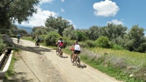
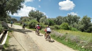
Why it matters: This is the sweet spot many operators overlook. The mud has dried, the heat hasn't arrived, and trail surfaces compact into firm, grippy hardpack. Wildflowers line the valleys. Temperatures at riding elevation hover between 15 and 25°C. Technical difficulty trails ride at their most predictable.
What it looks like today: Trail surfaces are stable. Visibility is excellent. Village water sources are flowing. This window offers the most accurate match between a trail's rated difficulty and its actual ride feel.
How to apply it: For clients who want the "truest" version of a trail's character, this is the booking window. It's also ideal for mixed-ability groups because surface consistency reduces the gap between experienced and intermediate riders. Consider pairing rides with a Toubkal summit trek while conditions allow.
4. Summer Heat and Dust Compaction (July to August)
Why it matters: Dust isn't just cosmetic. Fine particulate on hardpack creates a layer of ball bearings under tires, especially on descents. Corners that grip at 20°C become skating rinks at 38°C. Heat also compresses the rideable window to early morning and late afternoon, cutting effective trail time in half.
What it looks like today: Daytime temperatures at lower elevations can exceed 40°C. Dust plumes trail every rider, reducing group visibility. Water sources thin out. The trail surface looks solid but behaves unpredictably under braking.
How to apply it: Summer bookings should target routes above 2,500 meters where temperatures stay manageable. Pre-dawn starts are non-negotiable. Hydration logistics need to be planned, not assumed. This is not beginner season.
5. Autumn Stability and Crowd Reduction (September to November)
Why it matters: October in the Atlas Mountains is arguably the most underrated riding season. Daytime temperatures range from 15 to 22°C with rain risk under 10% , and trail traffic drops significantly after peak season. Surfaces are dry and stable. The light is extraordinary.
What it looks like today: Trails are in their most worn-in state after summer traffic, which actually improves line visibility. Berber villages are harvesting walnuts and apples. The cultural dimension of the ride deepens. For adventure tourism operators, this is where client satisfaction and referral rates climb.
How to apply it: Autumn is the strongest recommendation for first-time Atlas riders and for agents building repeat-client itineraries. Atlas Mountain Bike runs small group trips during this window with local guides who know which valleys catch the best afternoon light and which descents ride fastest on autumn-firm soil. It's worth a conversation if you're sourcing for this season.
6. Early Winter Freeze-Thaw Cycles (December to January)
Why it matters: The Atlas doesn't simply "get cold." It oscillates. Overnight freezing at altitude creates ice lenses in the soil that thaw by midday, turning the top two inches of trail into slurry while the substrate stays frozen. This is deceptive: the trail looks rideable in the morning (frozen solid) and again by late afternoon (dried surface), but the midday transition zone is treacherous.
What it looks like today: North-facing slopes stay frozen longer. South-facing slopes thaw earlier. The same trail can present three different surfaces depending on aspect and time of day. Standard trail assessment doesn't capture this.
How to apply it: Winter trips require guides who understand aspect and timing. Start rides on south-facing slopes in the morning, transition to north-facing by afternoon. Avoid midday riding on mixed-aspect traverses. This is expert-level route planning.
7. Post-Rain Flash Erosion (Variable, Most Common in March and November)
Why it matters: The Atlas receives most of its rainfall in short, intense bursts. A single storm can carve new drainage channels across a trail, deposit gravel fans at switchback bases, and undercut trail edges. A route ridden last week may have a new 30-centimeter drop where there was none before.
What it looks like today: Platforms like Trailforks track conditions like "Prevalent Mud" and "Wet," but they rely on user reports that may lag by days. In the Atlas, where trail users are sparse, digital condition reports are unreliable. Local intelligence is the only real-time source.
How to apply it: After any significant rainfall, confirm trail status through your guide operator, not through an app. Build buffer days into itineraries during March and November to accommodate weather holds. For agents, this is where partnering with operators who have deep local trail networks pays off, because they can reroute on the day without losing the quality of the ride.
The Pattern Beneath These Conditions
Three themes run through every seasonal shift above. First, elevation is a time machine: climbing 500 meters can move you backward in the season by weeks. Second, trail surface is the real difficulty metric, not gradient or exposure. A gentle slope in saturated clay is harder than a steep descent on dry rock. Third, the gap between digital trail data and ground truth widens in proportion to how remote the terrain is.
These conditions don't operate in isolation. A late snowmelt (Condition 1) compresses the hardpack window (Condition 3) and pushes mud season (Condition 2) later. A dry autumn (Condition 5) means more dust carry-over into early winter (Condition 6). Reading these interactions is what separates experiential terrain knowledge from static trail ratings .
Where to Start: Prioritizing for Real-World Planning
You don't need to master all seven conditions before booking. Start with three decisions: season (Conditions 3 and 5 are the safest bets for most clients), elevation band (stay below 2,500 meters in transitional months), and guide partnership (local operators who ride daily will always outperform any app or rating system).
If you're building an itinerary for the first time, focus on the autumn window. It forgives the most, delivers the most consistent surfaces, and gives your clients the cultural richness that turns a bike ride into a story they retell. Everything else is refinement.
Frequently Asked Questions
What is the best season for mountain biking in the Atlas Mountains?
October and November offer the most consistent conditions: stable trail surfaces, comfortable temperatures between 15 and 22°C, minimal rain risk, and significantly fewer crowds. Late May through mid-June is a close second, with firm hardpack and cooler riding temperatures at altitude.
How does trail assessment differ from standard trail difficulty ratings?
Standard ratings like the ITRS assign a fixed technical difficulty based on gradient, obstacles, and exposure. Trail assessment as a seasonal diagnostic adds surface condition, moisture state, and time-of-day variables. A trail rated "intermediate" can ride as advanced in mud season or as easy on autumn hardpack. The rating stays the same; the trail doesn't.
Can you ride Atlas Mountain trails during summer?
Yes, but only with significant adjustments. Temperatures at lower elevations can exceed 40°C, so rides should target routes above 2,500 meters with pre-dawn starts. Dust on hardpack reduces tire grip, especially on descents. Summer is not recommended for beginners or mixed-ability groups.
How reliable are trail condition apps for the Atlas Mountains?
Platforms like AllTrails and Trailforks are useful for well-trafficked trail systems, but their condition reports depend on user submissions. In the Atlas, where trail users are sparse, reports can lag by days or weeks. Local guide operators who ride daily remain the most reliable source of real-time trail intelligence.
What should adventure travel agents communicate to clients about seasonal conditions?
Be specific about what the trail will feel like, not just what it's rated. Tell clients whether to expect dust, mud, or hardpack. Set expectations about rideable hours in summer, potential weather holds in March and November, and the elevation-dependent nature of conditions. Overpromising on a fixed trail experience leads to disappointment; framing the variability as part of the adventure leads to better reviews.
Why do local guides matter more than trail maps in the Atlas?
The Atlas trail network includes village mule paths, seasonal shepherd routes, and unmarked singletrack that don't appear on digital maps. Conditions change after every storm. Local guides read micro-terrain signals (soil color, vegetation state, water flow patterns) that no map or app captures. This is the difference between navigating a trail and understanding it.