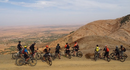
7 Signals No Endurance Trail Rating Will Tell You
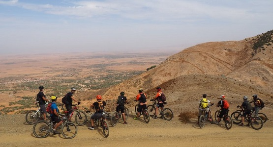
The diagnostic terrain intelligence experienced riders use to make real decisions on the ground
Discover seven ground-level signals that never appear on a standard endurance trail rating but determine how your ride actually ends. Learn the terrain intelligence gaps that separate riders who finish strong from those who push their bike home.
TL;DR
Trail ratings are static; trails are not - Surface conditions, weather, water sources, and cultural access all change daily and seasonally, but ratings treat them as fixed. The gap between description and reality widens in remote terrain.
Seven signals matter more than the rating - Surface transitions, heat/shade exposure, escape routes, technical-section timing relative to fatigue, wind patterns, water resupply reliability, and cultural land-use context all determine your actual ride experience.
Start with three priorities - Focus on surface composition changes, heat exposure, and escape route availability before your next unfamiliar ride. These have the highest impact on safety and energy management.
Difficulty is a relationship, not a property - Trail difficulty depends on the interaction between the trail, the rider, and the conditions on a specific day. Reading yourself against the terrain matters as much as reading the terrain itself.
Local knowledge updates faster than any app - A guide who rode the trail yesterday carries intelligence that no rating system, GPS track, or forum post can replicate, especially in remote mountain environments like the Atlas Mountains.
The Gap Between the Rating and the Ride
You studied the elevation profile. You checked the endurance trail rating. You even watched a helmet-cam video from two years ago. And still, three hours in, you're walking your bike up a loose switchback that the description called "moderate climbing."
This is the reality gap. Trail descriptions and rating systems are built to standardize, to compress a living, shifting landscape into a label you can compare across regions and continents. That's useful for planning. It's insufficient for riding. The International Trail Rating System (ITRS) itself acknowledges this by splitting assessment into four separate dimensions: technical difficulty, endurance, exposure, and wilderness. But even four dimensions can't capture what changes between the morning you read the description and the afternoon you ride the trail.
What follows are seven diagnostic signals that experienced riders and local guides use to make real decisions on the ground. None of them appear on a standard trail assessment. All of them determine whether you finish strong or push your bike home.
Who This Is For (and What It Skips)
This is for dedicated mountain bikers who already know how to read a trail rating and who have enough fitness to ride intermediate-to-advanced terrain. You don't need another explanation of what "blue" versus "black" means.
This list skips gear reviews, bike setup, and training plans. Instead, it focuses on the terrain intelligence that sits between the published description and the actual ride: the variables that change how a trail feels under your tires on a specific day, in a specific season, in a specific landscape.
How These Seven Signals Were Selected
Each item meets two criteria. First, it materially changes the difficulty or character of a ride but is consistently absent from standard trail descriptions and rating frameworks. Second, it's something a knowledgeable local guide would mention in the first five minutes of a pre-ride briefing. These are the things experience teaches you, often the hard way.
7 Things Your Endurance Trail Rating Won't Tell You
1. Surface Composition Changes Mid-Route
Why it matters: A trail description might say "rocky singletrack" or "hard-packed dirt," but most trails transition between multiple surface types. A route in the Atlas Mountains might start on compacted red clay, shift to loose shale on a ridge traverse, then drop into sandy wadi beds. Each surface demands a different tire pressure, body position, and braking strategy. The endurance cost of constant adaptation is invisible on paper.
What it looks like today: Rating systems treat surface as a static attribute. The ITRS grades technical difficulty partly on surface, but it assigns one rating to the whole route. Riders who plan around a single surface description get surprised by the transitions, which is where most mechanical issues and energy spikes happen.
How to apply it: Before any unfamiliar ride, ask about the number of distinct surface changes and where they occur relative to climbs and descents. If you're navigating Moroccan terrain , this is especially critical because the geology shifts dramatically within short distances. Run tire pressures that compromise between surfaces rather than optimizing for one.
2. Cumulative Heat Load Versus Shade Coverage
Why it matters: Weather and seasonal conditions can make an easy trail become moderate or hard , and heat is the most underestimated variable. A 30km ride at 2,000 meters with no tree cover is a fundamentally different effort than the same distance and elevation at sea level with forest canopy. Trail descriptions almost never quantify shade exposure.
What it looks like today: Riders check the temperature forecast but rarely map it against the route's shade profile. In North African mountain terrain, south-facing slopes above the tree line can be 10-15°C hotter in perceived temperature than a shaded valley floor two kilometers away. Your heart rate, hydration needs, and cognitive sharpness all shift accordingly.
How to apply it: Study satellite imagery of the route for vegetation density. Identify exposed sections and time your ride so you hit them in the cooler hours. Carry 50% more water than the distance alone suggests if the route is predominantly exposed. This is one reason riding with someone who knows the local terrain by season matters more than any app.
3. Escape Route Availability
Why it matters: The ITRS wilderness dimension explicitly includes rescue options, mobile phone reception, and water supply . But most trail descriptions treat a route as a single commitment. They rarely tell you where you can bail if your body, your bike, or the weather stops cooperating. On a three-hour loop, the difference between "you can cut to a road at the halfway mark" and "you're committed for the full distance" is the difference between a manageable day and a crisis.
What it looks like today: GPS tracks show the intended line. They don't show the shepherd's path that drops to a village at kilometer 18, or the fire road that intersects the ridge trail before the final technical descent. This kind of knowledge lives in the heads of people who ride the area regularly.
How to apply it: Before committing to any remote route, identify at least two bail-out points with access to a road or settlement. Mark them on your GPS. If you can't find this information online, that's a strong signal you need local guidance. For routes in the Atlas Mountains , Atlas Mountain Bike builds this kind of escape-route intelligence into every guided ride, because their local guides have ridden these trails in every season and know every connecting path.
4. The Timing of Technical Sections Relative to Fatigue
Why it matters: A trail with a crux technical section at kilometer 5 is a completely different ride than the same trail with that section at kilometer 35. Your physical condition on the day (fatigue, dehydration, depleted grip strength) determines whether a rock garden is fun or dangerous. Trail descriptions list technical features as if your body is a constant. It isn't.
What it looks like today: Research on trail difficulty assessment identifies effort, technique, and risk as interrelated factors, not independent ones. Yet most trail profiles present elevation and technicality as separate data. A rider who's been climbing for two hours has fundamentally different bike-handling capacity than one who just started.
How to apply it: When reviewing a route, map the technical sections against the cumulative elevation gain at that point. If the hardest feature comes after the biggest climb, plan your pacing to arrive with reserves. Consider walking a technical section you'd normally ride if it falls late in a demanding route. Ego costs nothing compared to a collarbone.
5. Wind Patterns and Microclimate Corridors
Why it matters: A sustained headwind on an exposed ridge can add 30-40% to the effort of a climb that's already rated as demanding. Mountain terrain creates wind corridors, valley funnels, and thermal drafts that change by time of day. None of this appears in any trail rating or description.
What it looks like today: Riders check wind speed at the nearest town and assume it applies to the trail. In mountain environments like the High Atlas, conditions at 1,500 meters and 3,000 meters can be entirely unrelated. Afternoon thermals can turn a calm morning ridge into a buffeting ordeal that affects line choice and safety on exposed traverses.
How to apply it: For mountain routes, plan to ride exposed ridgelines and high passes in the morning before thermal winds develop. Ask locals about prevailing wind directions by season. If you're exploring cycling routes in Morocco , this is the kind of detail that separates a memorable ride from a miserable one.
6. Water Resupply Reality Versus Distance
Why it matters: Trail descriptions sometimes note "water available" without specifying whether that's a reliable spring, a seasonal stream, or a village shop that closes at noon. On endurance rides in arid or semi-arid terrain, the gap between expected and actual water access is where rides fall apart. Dehydration degrades decision-making before it degrades muscles.
What it looks like today: Apps and guidebooks mark water points as static features. In reality, seasonal variation, upstream usage, and infrastructure changes mean a water source that existed last year may not exist today. In the Atlas Mountains, snowmelt streams that flow reliably in spring can be dry gravel by late summer.
How to apply it: Treat every water point as unverified until confirmed by someone who's been there recently. Carry enough water to reach the second resupply point, not just the first. On guided rides, this is handled for you. On self-supported rides, it's the single most important logistical question you can ask.
7. Cultural and Land-Use Context
Why it matters: Trails exist within communities. A path that crosses agricultural land may be open in winter and closed during harvest. A route through a village has different etiquette than a purpose-built bike trail. Livestock on the trail, irrigation channels across the path, and local customs about right-of-way all affect your ride. None of this appears in a trail assessment.
What it looks like today: Most trail databases treat routes as fixed infrastructure. In landscapes where trails are shared with farming, herding, and daily life, the route is a living system. In Morocco's mountain valleys, a trail might pass through a Berber village where stopping to greet people isn't just polite, it's how you learn that the bridge two kilometers ahead washed out last week.
How to apply it: Research the human landscape of your route, not just the physical one. Learn three phrases in the local language. Slow down through settlements. Riding with a local guide (as Atlas Mountain Bike arranges for routes from the Atlas to the Sahara ) transforms these encounters from obstacles into the richest part of the ride.
The Pattern Beneath These Seven Signals
Every item on this list shares a common trait: it's dynamic. Surface conditions change with weather. Heat load changes with season. Water sources change with snowmelt. Cultural access changes with harvest cycles. Trail ratings, by design, are static. They capture a snapshot and present it as permanent truth.
The deeper pattern is that trail difficulty is not a property of the trail. It's a relationship between the trail, the rider, and the conditions on a specific day. Experienced riders instinctively run this calculation before and during every ride. They're not just reading the terrain; they're reading themselves against the terrain. The best trail intelligence comes from people who maintain this relationship with the same routes across years and seasons.
This is also why the gap between a trail description and the actual ride widens the further you get from well-trafficked, well-maintained systems. Remote mountain terrain in places like Morocco, Nepal, or Patagonia rewards local knowledge disproportionately, because the variables multiply and the consequences of misjudging them increase.
Where to Start: Constraints and Priorities
You don't need to master all seven signals before your next ride. Start with three: surface transitions, heat exposure, and escape routes. These have the highest impact on safety and energy management, and they're the easiest to research or ask about in advance.
If you're planning a ride in unfamiliar terrain, especially remote mountain environments, the most efficient way to access this intelligence is through someone who rides there regularly. No app, rating system, or forum thread updates as fast as a guide who was on the trail yesterday. For everything else, carry extra water, leave ego at the trailhead, and remember that the best ride is the one you finish wanting to come back.
Frequently Asked Questions
What is the ITRS and how does it assess trail difficulty?
The International Trail Rating System (ITRS) evaluates mountain bike routes across four separate dimensions: technical difficulty, endurance, exposure, and wilderness. Rather than collapsing everything into a single label, it acknowledges that a ride can be technically easy but physically demanding, or low-exposure but deep in wilderness with no rescue access. It's the most nuanced widely-used system available, though it still assigns static ratings that don't account for daily conditions.
Why do trail ratings often feel inaccurate when you're actually riding?
Trail ratings capture a generalized snapshot of a route under assumed conditions. They can't account for the variables that change daily or seasonally: weather, surface moisture, wind, your fatigue level, or whether a water source has dried up. A trail rated "moderate" in spring can ride like "hard" in midsummer heat or after heavy rain. The rating describes the trail's potential, not your experience of it on a given day.
How can local guides improve a mountain biking experience beyond what apps provide?
Local guides carry real-time, experiential knowledge that no app updates fast enough to match. They know which stream crossings are rideable this week, where afternoon winds make a ridge dangerous, which village paths are open, and where you can bail out if something goes wrong. This terrain intelligence accumulates over years of daily riding and is especially valuable in remote mountain environments where conditions shift rapidly.
What should I prioritize when assessing an unfamiliar trail?
Focus on three things first: surface composition changes along the route (so you're not surprised by loose or sandy sections mid-climb), heat and shade exposure (which determines your hydration strategy), and escape route availability (so you have options if the ride goes sideways). These three factors have the highest impact on safety and energy management and are the most commonly omitted from trail descriptions.
How does weather affect trail difficulty beyond what ratings show?
Weather transforms every dimension of a ride. Rain turns hard-packed dirt into mud that clogs drivetrains. Heat increases heart rate, accelerates dehydration, and degrades decision-making. Wind on exposed ridges adds massive effort to climbs and creates balance hazards on technical traverses. Trail ratings assume neutral conditions, so any weather deviation from that assumption changes the actual difficulty you'll encounter.
Why is water resupply planning so critical for endurance mountain bike rides?
Dehydration degrades cognitive function and fine motor control before it affects raw power output. On endurance rides in arid or mountainous terrain, the difference between a marked water source and a reliable water source can be significant. Seasonal streams dry up, village shops close, and springs shift location. Carrying enough water to reach the second resupply point (not just the first) provides a safety margin that the distance alone doesn't suggest you need.