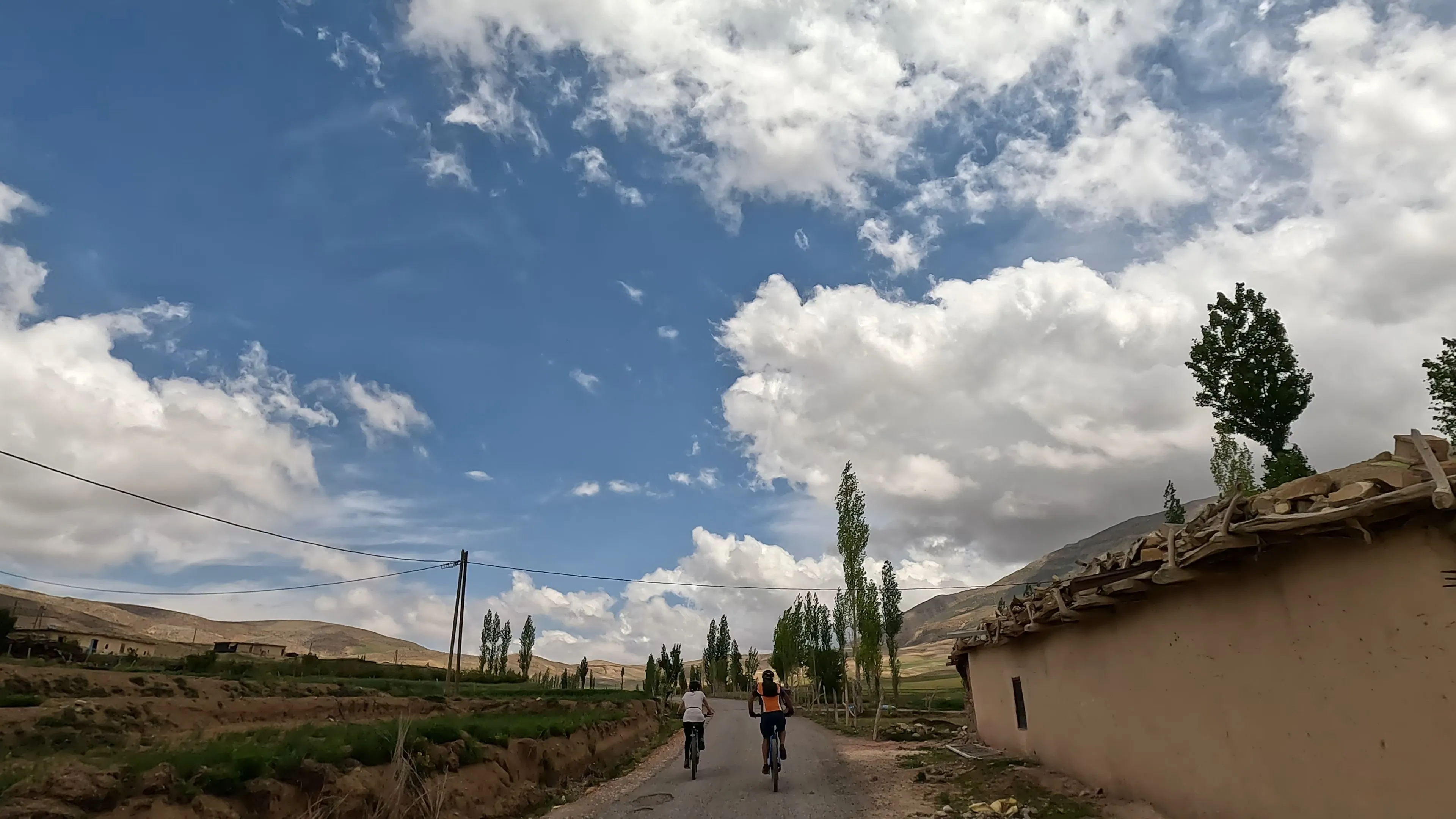
Naturerlebnisse: Build a Multi-Zone Atlas Itinerary
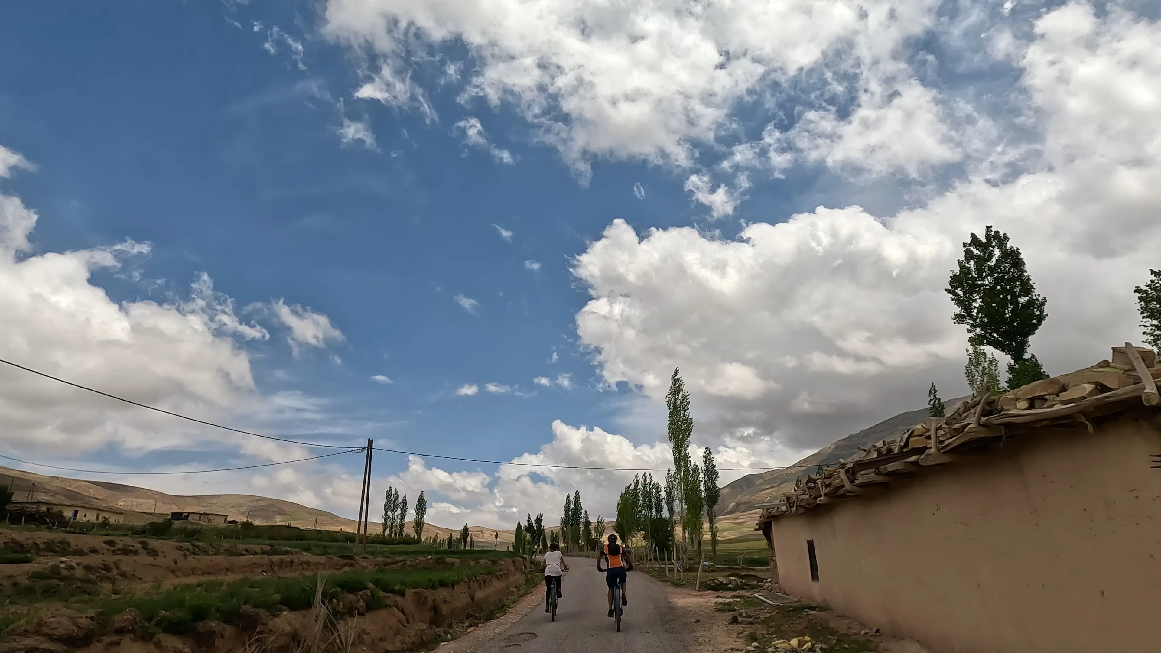
How terrain sequencing turns a mountain biking route plan into an immersive story for your clients
Learn how to curate a multi-zone Atlas Mountains biking itinerary that sequences terrain for sensory contrast and physical logic. This step-by-step tutorial helps you craft Outdoor Erlebnisse that feel like narrative arcs, not spreadsheets.
TL;DR
Sequence terrain by sensory contrast, not geography - Alternate exposed alpine zones with sheltered valleys and cultural immersion days so each day feels like entering a different world.
Map the energy arc first - Assign intensity ratings (1 to 5) to each day before choosing zones. A proven five-day pattern is 2-4-4-3-2, never stacking two maximum-effort days at the start.
Every day needs a sensory anchor - One specific, non-biking moment per day (a village tea ceremony, silence at altitude, a shared meal) is what clients remember and recommend.
Respect altitude physiology - Ride high but sleep low for the first two nights. Keep first-night sleeping altitude below 1,800 m to prevent early altitude sickness from derailing the trip.
Ground-truth with local operators - Your itinerary is a hypothesis until a guide who rides these trails weekly confirms that your zone transitions, sensory anchors, and elevation profiles are realistic for the season.
What You'll Build: A Multi-Zone Atlas Itinerary That Feels Like a Story
By the end of this tutorial, you will have a complete multi-zone Atlas Mountains biking itinerary that sequences terrain deliberately, so your clients experience genuine Naturerlebnisse rather than a blur of exhaustion. The finished product is a day-by-day route plan covering two to four distinct riding zones, each chosen for its sensory contrast and physical logic.
Your success criteria are simple. Read the final itinerary aloud. Does it feel like a narrative arc, with rising action, a summit moment, and a satisfying resolution? Or does it read like a spreadsheet? If the former, you've nailed it. If the latter, the terrain sequencing needs rework.
This approach separates coordinators who curate Outdoor Erlebnisse from those who merely schedule them.
Prerequisites and Setup
Before you begin, make sure you have the following in place. Missing even one item can stall your planning mid-step.
Client profile completed: fitness level, riding experience, altitude tolerance, group size, and any non-negotiable cultural interests (Berber villages, markets, overnight stays)
Topographic reference: access to a detailed Atlas Mountains elevation map (OpenTopoMap or similar) covering High Atlas, Anti-Atlas, and the Toubkal foothills
Seasonal window confirmed: know your travel month, as trail conditions in the Atlas shift dramatically between October and May
Zone research time: allocate 3 to 5 hours for the full build, plus one revision pass
A blank itinerary template: spreadsheet or document with columns for Day, Zone, Terrain Type, Elevation Range, Intensity (1 to 5), Sensory Highlight, and Recovery Note
Potential blocker: if you haven't ridden these zones yourself, partner with a local operator who has. Terrain descriptions from satellite imagery alone will mislead you.
Why Terrain Sequencing Matters More Than Distance
Most adventure coordinators build itineraries around kilometers and clock time. That logic works for road trips. It fails in the Atlas Mountains, where a 20 km day on loose volcanic scree at 2,800 meters feels fundamentally different from a 40 km day rolling through irrigated valley tracks.
72% of the German-speaking population say they are interested in spectacular landscapes while traveling, and over 60% cite "experiencing nature" and "recharging energy" as primary motives for visiting natural areas. Your clients are not chasing mileage. They are chasing feeling. Terrain sequencing is how you deliver that feeling on purpose rather than by accident.
The Atlas range offers something almost no other mountain biking destination does: radically different biking zones within a few hours of each other. High Atlas alpine passes, Anti-Atlas desert plateaus, Toubkal foothills with terraced villages, and Ourika Valley riverbeds each create a distinct sensory world. Your job is to arrange them so the body and mind absorb each one fully.
Step-by-Step: Building Your Multi-Zone Atlas Itinerary
Step 1: Map Your Client's Energy Arc
Before touching terrain, sketch your client's energy curve across the trip duration. A five-day trip typically follows this pattern: Day 1 is arrival energy (high enthusiasm, jet-lag fragility), Days 2 and 3 are peak capacity, Day 4 is accumulated fatigue, and Day 5 is emotional crescendo before departure.
Action: In your itinerary template, assign each day an intensity ceiling from 1 (gentle) to 5 (demanding). For a standard group of moderately fit riders on a five-day trip, a proven arc is: 2, 4, 4, 3, 2. Write these numbers in your Intensity column now.
Checkpoint: Your intensity column should never show two consecutive 5s. If it does, your clients will remember exhaustion, not landscape. For guidance on assessing whether clients are ready for sustained high-intensity days, see this pre-trip fitness diagnostic .
Common failure: Placing the hardest ride on Day 1 because "they're fresh." They are not fresh. They traveled internationally, slept poorly, and haven't acclimatized. Start moderate.
Step 2: Identify Your Available Zones
The Atlas Mountains contain at least four distinct biking zones, each with its own terrain personality. You need to understand what each one offers before you sequence them.
High Atlas Passes (2,500 to 3,200 m): rocky singletrack, thin air, panoramic exposure, sparse vegetation. Intensity: 4 to 5. Sensory signature: vast silence, wind, raw mineral landscape.
Toubkal Foothills (1,200 to 2,200 m): terraced Berber villages, walnut groves, mule tracks, moderate climbs with frequent cultural stops. Intensity: 2 to 3. Sensory signature: running water, green terraces against red earth, mint tea with families.
Anti-Atlas Plateau (800 to 1,600 m): wide desert tracks, volcanic rock gardens, ancient granaries, long sightlines. Intensity: 3 to 4. Sensory signature: heat shimmer, geological drama, solitude.
Ourika and Valley Floors (600 to 1,200 m): riverside trails, market towns, flat to rolling terrain, high cultural density. Intensity: 1 to 2. Sensory signature: sound of water, crowded village life, color.
Action: List which zones are accessible from your base location within a reasonable transfer time (under 2.5 hours by vehicle). Eliminate any zone that requires a transfer so long it eats the riding day.
Checkpoint: You should have at least three viable zones. If you only have two, the itinerary will feel repetitive. Consider adjusting your base location.
Step 3: Sequence Zones by Sensory Contrast, Not Geography
This is where curation separates from scheduling. The goal is to place zones in an order that maximizes the felt difference between consecutive days. Think of it as a meal: you would not serve four rich courses in a row.
Action: Lay out your zones and ask one question for each transition: "Will the rider feel like they entered a different world?" If the answer is no, swap the order. A strong five-day sequence might look like this:
Day 1: Ourika Valley (arrival day, gentle, sensory warmth)
Day 2: High Atlas Pass (dramatic escalation, physical challenge, visual awe)
Day 3: Anti-Atlas Plateau (different kind of hard, desert solitude after alpine intensity)
Day 4: Toubkal Foothills (recovery pace, cultural immersion, village hospitality)
Day 5: Valley return with a signature viewpoint finish (emotional closure)
Common failure: Sequencing by ascending difficulty alone. This creates a relentless upward grind that ignores emotional rhythm. Alternate intensity with recovery. Alternate exposed terrain with sheltered terrain.
Step 4: Assign Sensory Anchors to Each Day
Every day needs one moment your client will describe to friends later. This is not a bonus. It is the structural purpose of the day. Without it, the day becomes "another ride."
Action: In your Sensory Highlight column, write one specific, non-biking moment per day. Examples:
Day 1: Tea ceremony in a roadside village with views of the valley below
Day 2: Silence at 3,000 meters, engine off, no wind, nothing but rock and sky
Day 3: Lunch inside a centuries-old agadir (fortified granary) with a local guide explaining its history
Day 4: Riding through walnut harvest activity, stopping to eat fresh walnuts with a farming family
Day 5: Sunrise viewpoint before the final descent
Checkpoint: If your sensory anchors all involve food, diversify. If they all involve views, diversify. The goal is variety across senses: taste, sound, touch, visual scale, social warmth.
Step 5: Validate Elevation Transitions
Abrupt altitude changes between days can cause headaches, nausea, and poor sleep. Your sequencing must respect physiology, not just aesthetics.
Action: Check that no single day involves a net altitude gain exceeding 1,200 meters for intermediate riders. If your Day 2 starts at 1,200 m and peaks at 3,000 m, that's an 1,800 m gain. Break it across two days, or add a vehicle-assisted transfer to a higher starting point.
For groups unfamiliar with altitude, watch for the subtle signals that riders are struggling. This guide on on-trail altitude fitness signals is worth sharing with your ground team.
Common failure: Ignoring that sleeping altitude matters more than riding altitude. A rider can climb to 3,200 m during the day, but sleeping above 2,500 m on the first night often degrades recovery. Plan overnight locations at moderate elevation whenever possible.
Step 6: Build in Structured Flex Time
Rigid itineraries break on contact with reality. Weather shifts. A client's knee flares. A trail is washed out from recent rain. Your itinerary needs built-in flexibility without looking unfinished.
Action: For each day, identify one "expandable" segment and one "compressible" segment. The expandable segment is a section you can extend if the group is strong and eager (an optional singletrack loop, a longer cultural stop). The compressible segment is a section you can shorten or skip without losing the day's sensory anchor.
Checkpoint: If removing the compressible segment makes the day feel hollow, your sensory anchor is in the wrong place. Move it to a non-negotiable part of the route.
Step 7: Write the Narrative Summary
This is the step most coordinators skip, and it is the step that sells the trip. Translate your spreadsheet into a short, evocative paragraph for each day. This is what goes into your client-facing proposal.
Action: For each day, write 2 to 3 sentences that describe the experience, not the logistics. Compare these two versions:
Logistics version: "Day 2: Transfer to Tizi n'Test. 35 km ride, 1,400 m elevation gain. Lunch at village. Return to hotel."
Narrative version: "Day 2: You climb out of the valley and into the High Atlas on rocky mule tracks that have connected villages for centuries. The air thins. The green disappears. By midday, you are riding a ridgeline with nothing but stone and sky in every direction. Lunch is hot tagine in a village that has no road access, only trails."
Checkpoint: Read your narrative version to someone who has never been to Morocco. If they lean forward, you've succeeded. If they nod politely, rewrite.
Step 8: Ground-Truth with a Local Operator
Your itinerary is a hypothesis until someone who rides these trails weekly validates it. Seasonal trail conditions, village accessibility, and weather patterns change in ways that no map or blog post can capture.
Action: Send your completed itinerary to a local guide team for review. Specifically ask them to flag any zone transition that is impractical given current conditions, any sensory anchor that is seasonally unavailable, and any elevation profile that is unrealistic for your stated client fitness level.
Operators like Atlas Mountain Bike specialize in exactly this kind of ground-level validation. Their guides ride these zones year-round and can tell you whether that ridgeline you planned for Day 3 is rideable in March or buried under late-season snow. This step is not optional. It is the difference between a curated Reitabenteuer and a logistical disaster.
Step 9: Finalize the Client-Ready Document
Action: Compile your itinerary into a clean document with the following sections for each day: Zone Name, Terrain Type, Riding Distance and Elevation, Intensity Rating (1 to 5), Sensory Anchor, Expandable and Compressible Segments, and the Narrative Summary.
Add a cover page with the overall trip arc described in one paragraph, the client fitness requirement, and the best-case and worst-case weather scenarios for the travel dates.
Checkpoint: The finished document should be under four pages. If it is longer, you are over-explaining logistics and under-delivering narrative. Cut transfer details and add sensory language.
Configuration and Customization
Key Variables to Adjust Per Client
Intensity ceiling: For experienced riders, you can push the arc to 3, 5, 4, 3, 2. For families or mixed groups, flatten it to 2, 3, 3, 2, 1.
Zone count: Three zones is the minimum for sensory contrast. Four is ideal for trips of five or more days. More than four in a week feels rushed.
Cultural density: Some clients want deep village immersion every day. Others want solitude and speed. Adjust your Toubkal Foothills and Ourika Valley days accordingly.
Transfer tolerance: If your client group dislikes long vehicle transfers, cluster your zones geographically and sacrifice some contrast. If they are comfortable with 2-hour transfers, you unlock the Anti-Atlas as a viable mid-trip zone.
Safe Defaults
For a first-time Atlas client with moderate fitness: five days, three zones, intensity arc of 2-4-3-3-2, no sleeping altitude above 2,200 m, and at least one full cultural immersion day. This is your fallback when the client profile is vague.
For terrain-specific preparation advice to share with clients before departure, this guide to navigating Moroccan terrain covers gear, hydration, and riding technique across different Atlas zones.
Verification and Testing
Before sending the itinerary to your client, run these three checks.
The contrast test: Read only the Zone and Sensory Highlight columns. Do consecutive days feel distinct? If Days 3 and 4 both say "rocky plateau" and "panoramic views," you have a contrast failure. Swap one zone.
The fatigue test: Add up all elevation gains across the trip. For a moderate group, total net climbing should stay under 5,000 m for a five-day trip. Above that, you risk cumulative fatigue overriding the experience.
The storytelling test: Can you describe the trip in three sentences that make someone want to go? If not, the arc lacks a clear peak moment. Identify which day is the emotional summit and make sure it has the strongest sensory anchor.
Edge case to verify: if your itinerary includes a rest day, make sure it is not placed after the easiest riding day. Rest days feel earned after effort. After a gentle day, they feel like wasted time.
Common Errors and Fixes for Atlas Itinerary Builds
Symptom: Client feedback says "beautiful but exhausting." Cause: No recovery days or compressible segments built in. Intensity stayed at 4 or 5 for three or more consecutive days. Fix: Insert a Toubkal Foothills or valley day after every high-intensity zone. Drop the intensity ceiling on Day 4 by at least one point.
Symptom: Client says "it all blurred together." Cause: Insufficient zone contrast. You likely used two zones that share similar terrain profiles (e.g., two high-altitude rocky zones back to back). Fix: Replace one zone with its sensory opposite. Follow exposed alpine terrain with sheltered green valleys. Follow desert silence with village bustle.
Symptom: Guide reports that the group was "behind schedule every day." Cause: Itinerary was built around best-case riding speeds without accounting for photo stops, mechanical issues, or slower riders. Fix: Add 30% buffer time to every day. If the ride should take 4 hours, schedule 5.5 hours. Use the surplus for organic exploration, not more kilometers.
Symptom: Altitude sickness on Day 2. Cause: Sleeping altitude jumped too fast. The group went from sea-level arrival to sleeping above 2,500 m within 36 hours. Fix: Keep first-night sleeping altitude below 1,800 m. Ride high, sleep low for the first two nights.
Symptom: Client loved the riding but felt "disconnected from Morocco." Cause: Sensory anchors were all landscape-based with no human or cultural contact points. Fix: Add at least two days with village stops, shared meals, or guided cultural context from a local. The terrain is the stage; the people are the story.
Next Steps and Extensions
Once you have built your first multi-zone itinerary, these extensions will deepen your curation skills and expand your offering.
Seasonal variants: Build a winter version (November to February) and a spring version (March to May) of the same itinerary. Trail conditions, daylight hours, and village accessibility shift enough to require different zone sequencing.
Multi-sport layering: Add a half-day hiking segment or a cooking workshop as a non-riding interlude. This is especially effective on recovery days and broadens your appeal to mixed-interest groups. For first-time riders considering Morocco, this beginner's guide to biking through Morocco pairs well as a pre-trip resource.
Client feedback loop: After each trip, ask clients to rank days by memorability, not enjoyment. The most memorable day reveals what your sequencing did right. Build future itineraries around that pattern.
Frequently Asked Questions
How many riding zones should a multi-day Atlas itinerary include?
Three zones is the minimum for meaningful sensory contrast. Four is ideal for trips of five days or longer. Going beyond four zones in a single week tends to create a rushed, checklist feeling rather than immersion. The goal is depth within each zone, not breadth across the map.
What is the best time of year for mountain biking in the Atlas Mountains?
The most reliable windows are March through May and September through November. Summer heat makes low-altitude zones punishing, and winter snow can close High Atlas passes above 2,500 m. Spring offers the best combination of mild temperatures, green valleys, and accessible high-altitude trails.
How do I assess whether my clients are fit enough for a High Atlas itinerary?
Start with a pre-trip fitness questionnaire covering weekly riding volume, altitude experience, and heat tolerance. For a moderate Atlas itinerary, clients should be comfortable riding 30 to 50 km per day with 800 to 1,200 m of climbing. If in doubt, build the itinerary around an intensity arc that peaks at 3 rather than 4 or 5.
What makes the Atlas Mountains different from other mountain biking destinations for tour design?
The Atlas range compresses radically different terrain types into short distances. You can ride alpine singletrack at 3,000 m in the morning and descend into a subtropical river valley by afternoon. This geographic compression gives itinerary designers more sequencing options than destinations where terrain stays uniform for long stretches.
Should I include rest days in a five-day Atlas biking itinerary?
For moderately fit groups, a dedicated rest day is usually unnecessary if your intensity arc includes lower-effort days (rated 2 or below). Instead of a full rest day, use a cultural immersion day with light riding (15 to 20 km on flat terrain) as active recovery. Full rest days work better on trips of seven days or more.
How important is it to work with a local guide operator for Atlas itineraries?
It is essential, not optional. Trail conditions, village accessibility, and seasonal weather patterns change in ways that remote research cannot capture. A local operator validates your terrain sequencing against current reality and prevents logistical failures that damage client trust and safety.